Cave mapping course
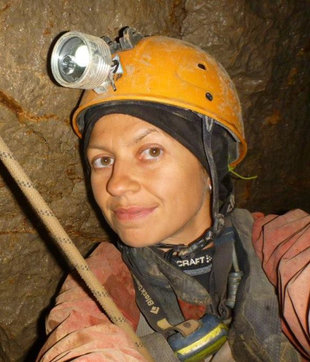
Taught by Tony Vlaykova and Encho Enchev.
- Dates
- 21.3-25.3
- Course price
- 1500 ILS
A 5-day course in which we deal with subjects related to the mapping and survey of unknown caves. The course contains basic and important information that every cave researcher needs.
The theoretical part of the course includes lessons on the Disto device, on the TopoDroid app, and an introduction to cartography.
The practical part takes place in the field, where we practice mapping in practice.
Graduates of the course will know how to map independently, and will also learn to lead a survey and mapping team in a cave. The course combines scientific work with fascinating activity in nature.
Registration is conditional on a payment of 1500 ILS.
Cancellation policy:
- Up to two weeks before the course: full refund
- Up to one week before: 50% refund
Course topics
Caving (speleology) is a far more complex activity than cave tourism (speleotourism). Speleology includes, among other things, survey, mapping and cartography. Creating accurate and detailed maps is a basic and important component of caving.
These maps can be used to compare different characteristics of caves, to provide a broad foundation for other fields of science and research, and to help visitors find their way in a cave. Mapping is usually accompanied by writing the cave report, an equally important component that serves as the basis for future research.
Cave survey and mapping is an important process but sometimes also a long and complex one. Cave surveyors need as broad and deep knowledge as possible in a variety of relevant fields: geology, archaeology, geomorphology, zoology, climate, mapping and cartography. The mapping tools are very sensitive and require great skill and attention to operate. The map itself ('on paper') is the product of the survey and sometimes takes long weeks to produce. Recent technological developments allow cave surveyors to reach a higher level of mapping using new instruments such as DistoX and a Lidar system, which makes the process faster, easier and more accurate and detailed. In addition, current software allows us to create three-dimensional models of caves and add information such as temperature differences, water, etc.
The survey and mapping course of the caving school deals with many subjects related to efficient and complete research of unknown caves. The course contains basic and important information that every cave researcher needs. The theoretical part of the course includes lessons on the Disto device, on the TopoDroid app, and an introduction to cartography. The practical part takes place in the field, in a cave, where participants will create a full and useful cave map, and will also practice a variety of practical subjects related to cave research. Graduates of the course will be given the tools to independently create a map and a full cave report, and to lead a survey and mapping team in a cave. The course combines scientific work with fascinating activity in nature.
Basic requirements
- All participants must be SRT certified with a full personal kit. Those who are not can take only the horizontal part of the course, without mapping vertical caves (day 4 of the course)
- All participants are advised to buy personal accident insurance.
- Participants must be at least 18 years old.
- All participants must declare good health and be in good physical shape.
- Caving is an intensive activity that carries many risks. All participants will be required to sign a health declaration, which includes understanding and accepting the possible risks and avoiding dangerous actions. The document will be provided separately to those interested
- All participants must obey the laws and the ethical norms practiced in the country and conveyed by the instructors
- A high level of English - writing and reading
- Participants must follow the instructors' directions absolutely, including keeping to schedule.
- Every participant must have a full kit including a helmet, closed shoes, caving clothes, two lamps and full SRT equipment
- A millimetre graph-paper pad
- A pencil and an eraser
- An Android mobile device, preferably with a stylus, with the app installed (see below)
- One DistoX device for every two participants
- A camera (a phone camera can be used)
Materials to download
Before the first meeting, please download and install the following software:
Android
TopoDroid - the Android app for use with DistoX
https://play.google.com/store/apps/details?id=com.topodroid.DistoX
iNaturalist - an app for surveying plants and animals
https://play.google.com/store/apps/details?id=org.inaturalist.android
Programme by day
Day 1 – Lecture
- Introduction to cave mapping, cave symbols and cave maps: purpose, how to understand and to work with them.
- Introduction to DistoX and TopoDroid.
- Main features of TopoDroid.
Day 2 - First practice in the cave with mapping of simple cave features: galleries and halls
- Getting to know the research site. Building a survey strategy. How to choose survey points, different types of survey points.
- Practice: pairing the devices; calibration; starting new survey; taking shots and downloading them; creating a sketch – plan view, extended profile view; drawing the sketch; completing the survey; making a ZIP backup and exporting the data and sketch.
Day 3 – Practice in horizontal cave
- Mapping complicated cave features – labyrinths, layers, polygons. Upgrading the knowledge from the previous day.
- Adding photos (pictures associated to survey shots) and audios (audio comments associated to survey shots).
- Transferring of exported files to the PC. Additional processing to see the results as a completed caving map.
Day 4 – Practice in vertical cave
- Mapping vertical parts of the cave. Connection between horizontal and vertical parts.
- Creating cave maps and cave descriptions. Visual representations of cave features. 3D models.
Day 5
- On this day, participants (split in groups) will try to apply everything learned from the course by creating completely functional original maps of an unknown small caves with horizontal and vertical parts. The participants will work independently and must demonstrate that they understand and can apply everything learned during the course. At the end of the day the participants will present their work, together with cave description.
Course price
Course price: 1500 ILS
The price includes
- Instruction
- Shared course equipment (ropes, survey and documentation equipment)
The price does not include
- Travel
- Personal accident insurance
Logistics
Course start: 21.3.23, morning
Course end: the evening of 25.3.23 - 5 full days.
Participants must get to the course location on their own.
Mandatory equipment for participants
- Full personal SRT equipment
- Helmet
- Headlamp
- An additional spare lamp,
- Pantin (recommended, not required)
Personal caving equipment
- Caving suit
- Base layer or leggings and a warm undershirt
- Gloves
- Boots